Login
Registered users
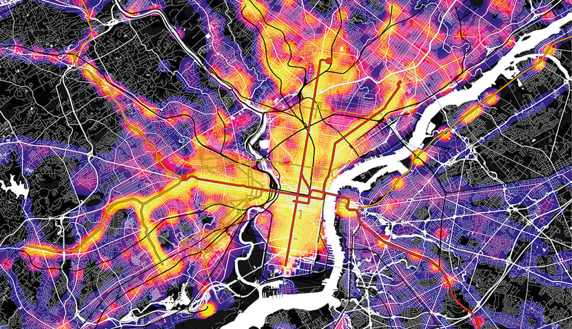
We return to North America to look at the city of Philadelphia, whose metropolitan area has 6 million inhabitants, making it the fifth largest city in the US. 1.5 million people live within the city precincts.
As usual, we present five GIS-based maps to help us read the city. The first, the population map, is the blueprint against which to interpret the other four that show the geographical features, service provision, public transport density, parks and green areas, respectively.
Philadelphia grew up on the right bank of the Delaware River. A tributary, the Schuylkill, runs through the city and the oldest quarter lies between these two watercourses. A first striking feature evidenced by the population distribution map is that, unlike other mature Western cities, the old city centre appears a densely inhabited, lively place.
It is laid out according to the typical orthogonal grid of American cities, a lattice structure that ensures widespread connectivity, with perimeter roads leading out across the rivers to slip seamlessly into the imposing highway network. Philadelphia lies on the I-95 highway running along the east coast of the USA from Maine to Florida. The I-76 and I-676 highways leading west run under the city. Links to nearby New Jersey are across bridges spanning the Delaware River. In contrast, the south of the city has few residents. This is the area of Philadelphia’s large port, a central hub on this navigable river, as well as its airport.
The contour map shows that the metropolitan area is a flat plain, as is the older city centre locked between the Delaware and Schuylkill Rivers.
The services map aligns very well with the population density map, showing that services are where people are, in the central area.
Similarly, public transport, organised as a large cross-shaped network inside the orthogonal city grid, speaks of efficient overland transport systems.
This is...

Digital

Printed


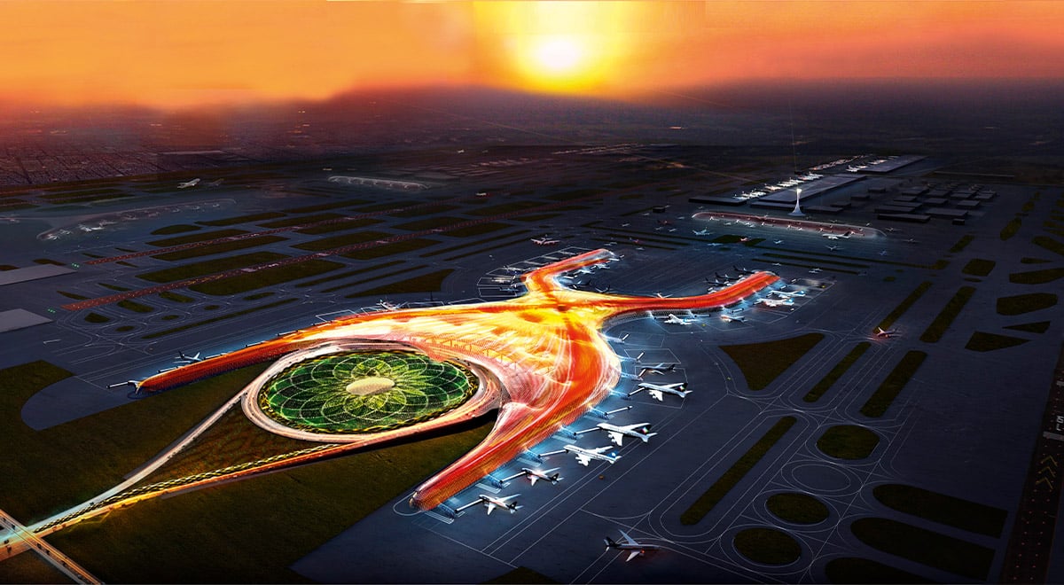
FR-EE Mexico City International Airport and Teotihuacan
Fernando Romero
Less than an hour north of Mexico City, the city of Teotihuacán has become synonymous with pre-Colombian Mesoamerican spiritual and cosmologically or...
A COLONIAL GRID SUSTAINS PHILADELPHIA’S CHARACTER
The Philadelphia Museum of Art is a noble neoclassical building on a remarkable site. It is both a terminus and a beginning, as it connects the urban ...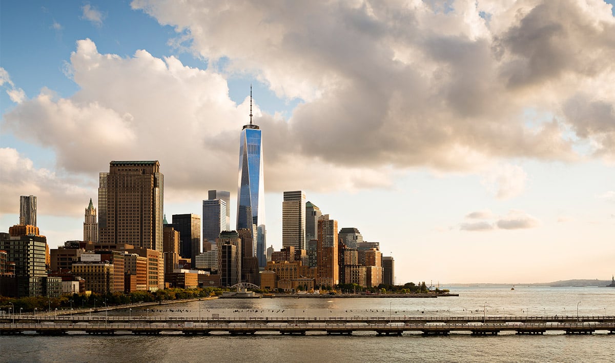
Freedom Tower at One World Trade Center - Proud and Soaring Thing New York, USA
SOM | Skidmore, Owings & Merrill
On 4 November 2014, the “Freedom Tower”, located at One World Trade Center, was officially inaugurated in a ceremony by Andrew Cuomo, Governor of ...